English

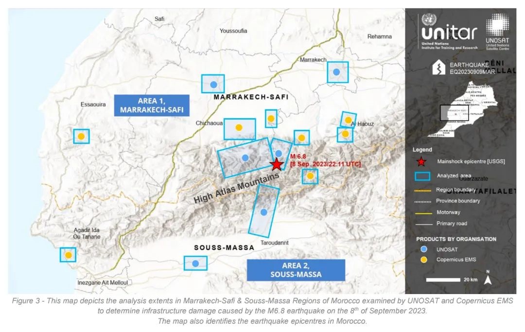
On September 28, 2023, the United Nations Institute for Training and Research (UNITAR) officially released the earthquake disaster assessment report for Morocco on September 8. Chang Guang Satellite Technology Co., Ltd. initiated a disaster emergency response for this earthquake, quickly coordinating the deployment of resources from the "Jilin-1" constellation satellites to obtain post-disaster programming data and submit it to the National Comprehensive Earth Observation Data Sharing Platform as soon as possible, providing information basis for disaster assessment, decision-making, and disaster reduction and relief work. In this disaster assessment process, "Jilin-1", as the only high-resolution Chinese satellite selected from the international disaster reduction cooperation satellites, has been highly recognized by UNITAR and the National Remote Sensing Center.

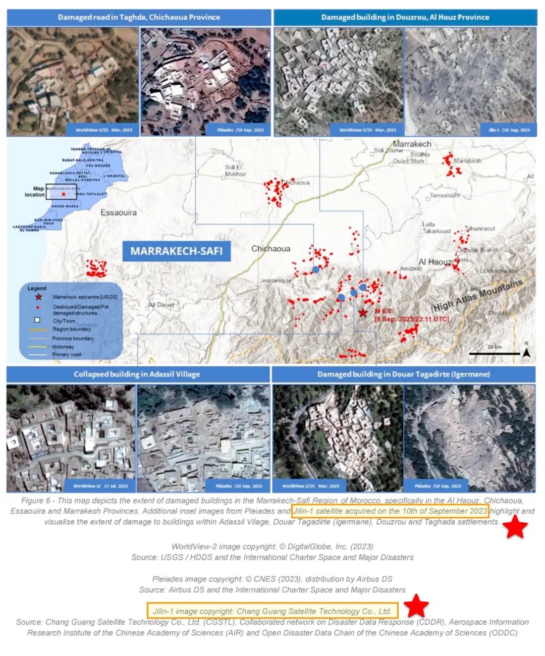
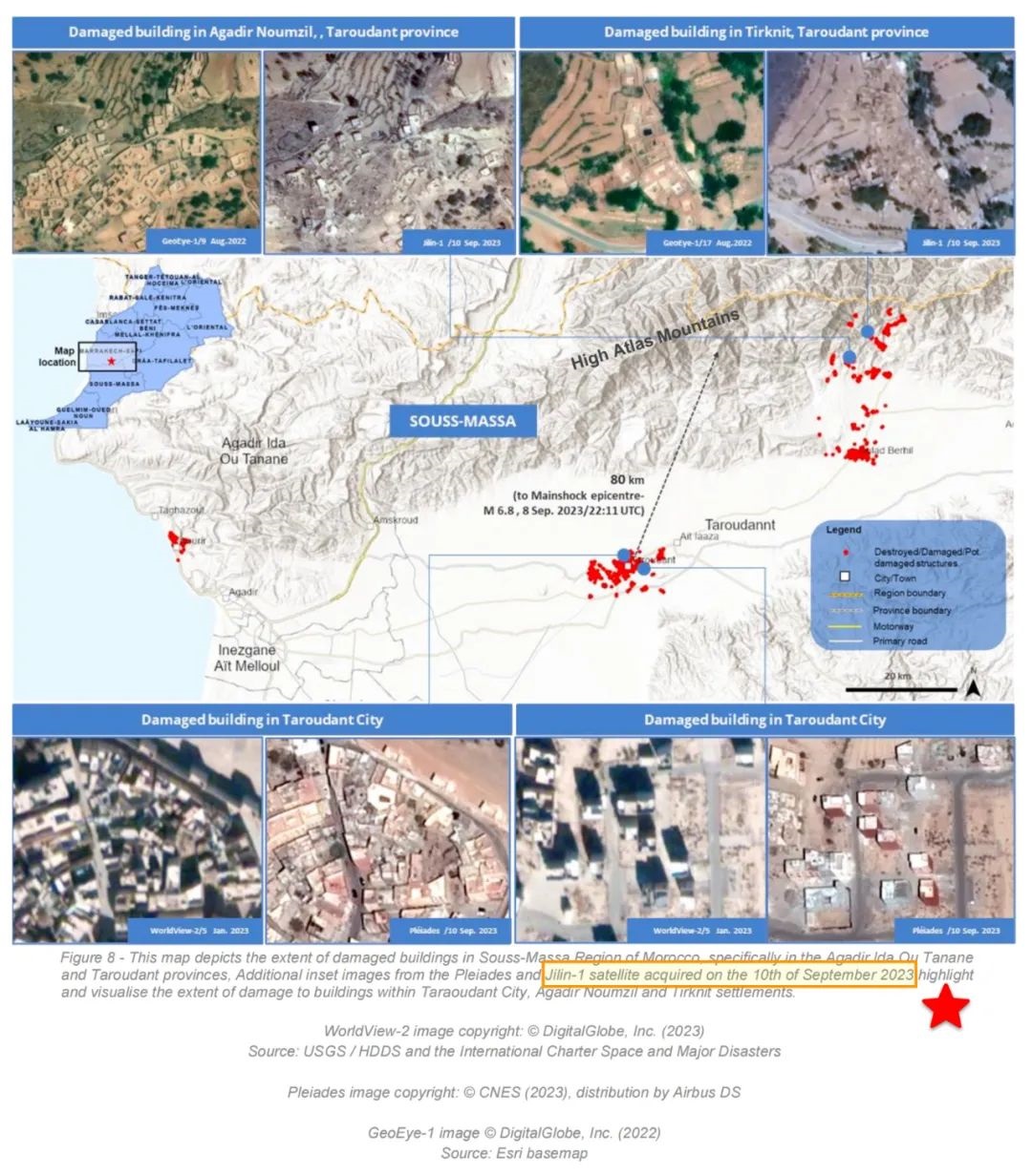
Chang Guang Satellite obtained remote sensing data of the Morocco earthquake on September 10, 2023, through emergency scheduling of the "Jilin-1" high-resolution satellite, clearly showing the extent of damage to buildings in various areas such as Adhasir Village, Duaelta Gadirte, Duzlu, Tagada, and Talaouant. This provides effective basis for disaster relief work.


Chang Guang Satellite Technology Co., Ltd. will continue to strengthen cooperation with China GEO and further promote the application of remote sensing satellite system in global major disaster monitoring and assessment, making due contributions to the technological support for building a community with a shared future for mankind.