English
"Gabrielle" landed in the northernmost part of the North Island of New Zealand on the 13th, bringing large-scale floods to the region, especially the Hawke's Bay area in the east of the North Island was severely affected.
After the New Zealand hurricane disaster, Chang Guang Satellite quickly coordinated and dispatched "Jilin-1" series satellite resources, opened an emergency observation plan, and submitted high-resolution remote sensing data before and after the disaster to the National Comprehensive Earth Observation Data Sharing Platform and other relevant departments in the first time.
According to the latest disaster area images taken by the Jilin-1 satellite yesterday, it can be found that the floods caused by Hurricane "Gabrielle" near Hawke's Bay in New Zealand have submerged many residential areas. The floods mixed with yellow mud gradually flowed towards the coast through residential areas and formed an obvious color difference with clear seawater at the estuary. The Hawke's Bay area is the hardest hit area in this hurricane disaster.
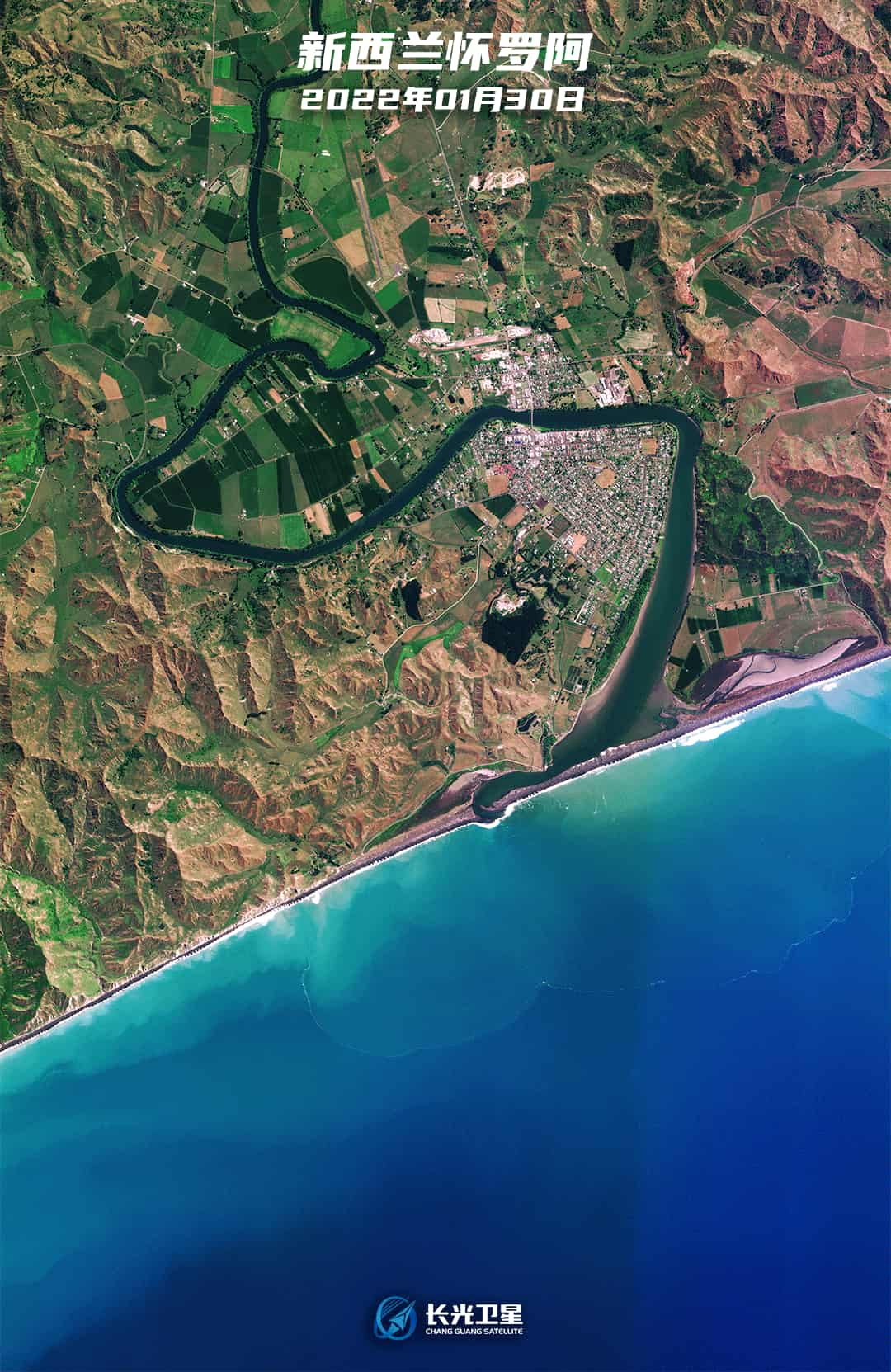
In the Hawke's Bay area, the floods caused by the hurricane submerged nearby farmland.
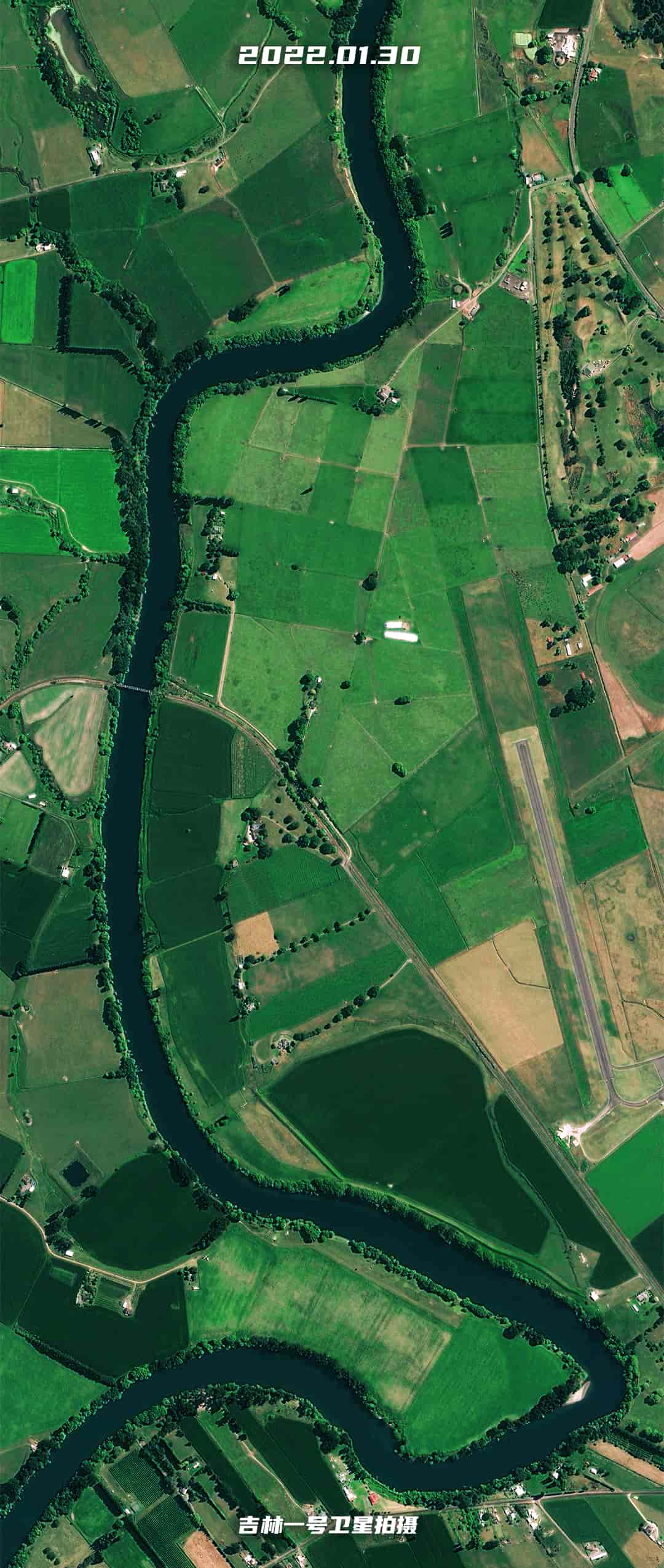
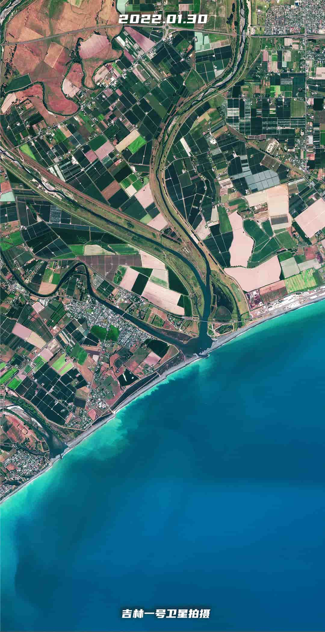
In the Hawke's Bay area, the floods mixed with yellow mud formed an obvious color difference at the estuary with clear seawater.

From the satellite images, most parts of Hawke's Bay are still under flood attack.
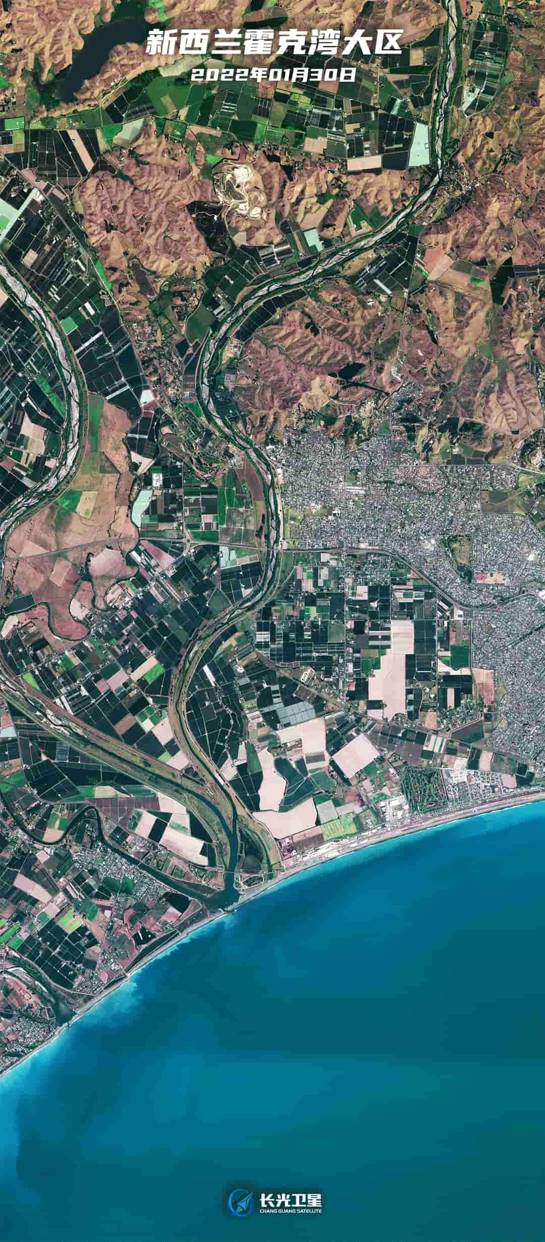
In the Puketapu area, the satellite discovered that farmland with lower terrain on both sides of the river has been flooded.
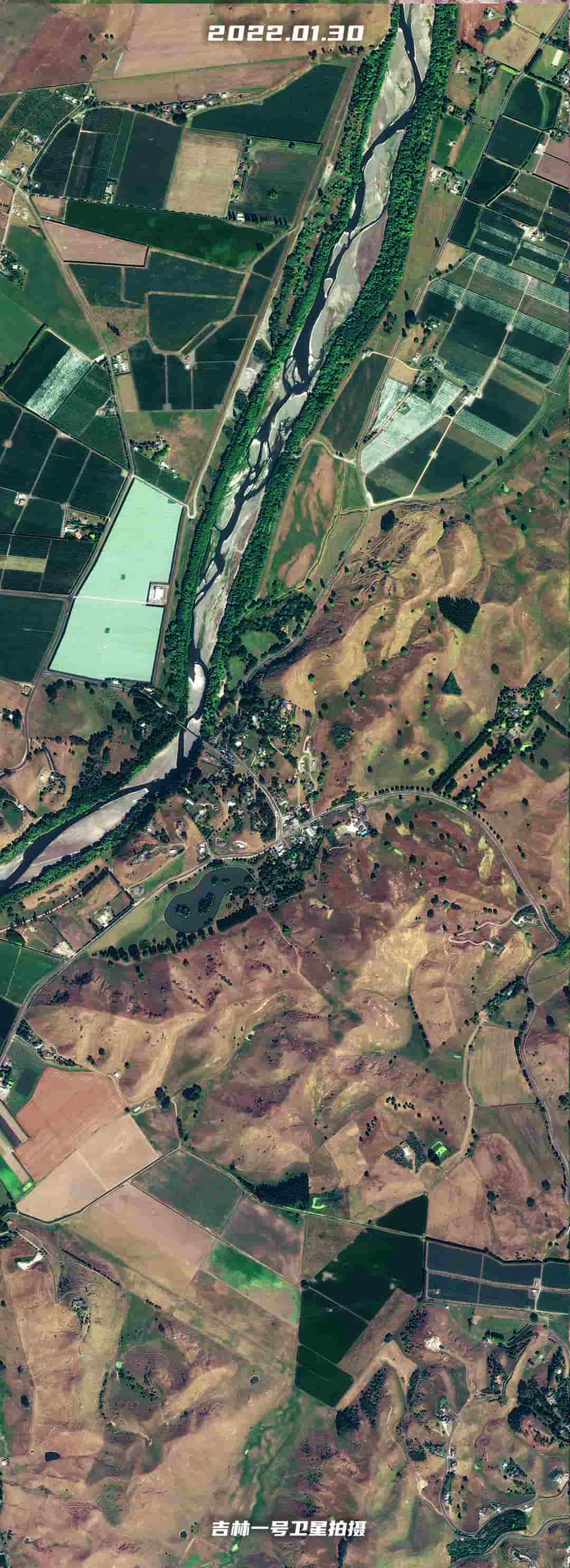
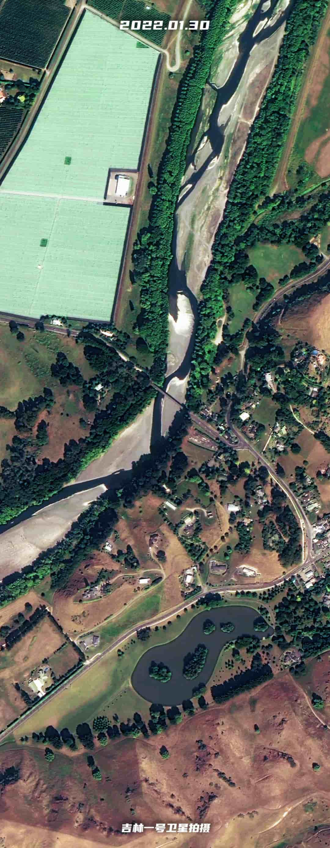
In the Puketapu area, a bridge named Vicarage Road was damaged.
Near the Pakowhai area, two rivers mixed with mud and sand and flowed into the estuary along the residential area. The mud and sand at the shore also formed an obvious color difference with clear seawater due to erosion.
In the Pakowhai area, the satellite once again discovered that a bridge named Brookfields Bridge was damaged.

The New Zealand government issued a statement on the 20th, stating that the national state of emergency will be extended for 7 days from now on to better cope with the severe losses caused by Hurricane "Gabrielle". The statement said that as the relief work deepens, the huge impact and losses after the hurricane will gradually become clear.
New Zealand Prime Minister Hipkins said at a press conference on the 20th that the scale of this hurricane disaster is unprecedented. More than 10,000 people were affected and relocated, which is the largest scale since the 2011 Christchurch earthquake. Currently, the hurricane has weakened and left New Zealand, and it will take a long time to recover from the disaster.
