English
In today's era of technological advancements, satellite imagery plays a crucial role in understanding and tracking environmental changes. As our planet continues to face numerous challenges related to climate change, it becomes imperative to harness the power of satellite image processing techniques to gain valuable insights into the impact of these changes. In this blog, we will delve deeper into the importance of satellite image processing techniques and their role in climate science.
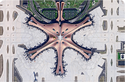
Satellite image processing techniques offer a unique and comprehensive perspective on environmental changes. By capturing high-resolution images of Earth's surface from space, satellites provide a bird's-eye view of various phenomena, such as deforestation, urbanization, and natural disasters. These images serve as powerful tools for climate scientists, enabling them to monitor and analyze long-term trends, identify patterns, and make accurate predictions about future scenarios.
The processing of satellite images involves a series of complex algorithms and techniques. These techniques include image registration, denoising, feature extraction, and classification, among others. Image registration ensures that images taken at different times and from different satellites are accurately aligned, allowing for meaningful comparisons. Denoising techniques help to remove unwanted noise from images, enhancing their clarity and quality. Feature extraction involves identifying specific objects or land cover types within the satellite images, such as forests, lakes, or urban areas. Finally, classification algorithms are employed to categorize the extracted features and create detailed maps of the environment.
Satellite image processing techniques find numerous applications in climate science. One such application is the monitoring of deforestation and its impact on the environment. By analyzing satellite images over a period of time, scientists can quantify the extent of deforestation, identify the causes, and assess the loss of biodiversity and carbon emissions associated with it. This information is invaluable for policymakers and conservationists, as it helps in formulating effective strategies for forest conservation and management.
Another important application is the tracking of natural disasters, such as hurricanes, floods, and wildfires. Satellites equipped with advanced sensors can capture real-time images of these events, allowing scientists to assess their intensity, track their paths, and understand the factors contributing to their formation. This information aids in developing early warning systems and evacuation plans, ultimately saving lives and mitigating the impact of such disasters.
In addition, satellite image processing techniques are also utilized in climate modeling. By assimilating satellite data into climate models, scientists can improve the accuracy and reliability of predictions regarding temperature changes, sea-level rise, and precipitation patterns. This enables policymakers to make informed decisions related to adaptation and mitigation strategies, ensuring the sustainable development of communities in the face of climate change.
In conclusion, satellite image processing techniques have revolutionized the field of climate science by providing invaluable data about environmental changes. These techniques enable scientists to monitor trends, identify patterns, and make accurate predictions, ultimately helping us to understand and address the challenges posed by climate change. As the importance of climate science continues to grow, it is crucial to further develop and refine satellite image processing techniques, ensuring a sustainable and resilient future for our planet.
